
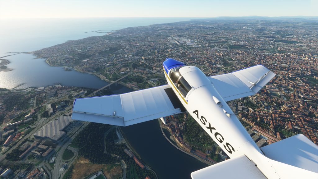
Good afternoon Ladies and Gentlemen, this is your captain speaking. I would like to welcome you to Can you really fly an Airplane? Airline This is flight number somewhere between 0 and 7 going around and roundabout Porto, Portugal. We will be in the air for a total time of 15 to 20 minutes while we read what is left of this article. Please be sure you are seated and your seatbelt is fastened at all times while the light is on. Get ready for takeoff.
Ladies and Gentlemen, I have turned off the seatbelt sign, you can now relax and enjoy some facts about your destination. Porto is the second-largest city in Portugal and ranks atop the Iberian Peninsula’s major urban centers. Nearly 2 million inhabit it’s metropolitan area and it is estimated to fit them all within 2.395 square kilometers. Porto rests north of the Douro River Estuary and is considered by many historians as one of the oldest European Centres.
Porto features a warm Mediterranean climate being clearly influenced by its oceanic location. As a result, Porto’s climate is usual pretty tame, with warm, sunny and dry summers interrupted by mild temperate but very rainy winters.
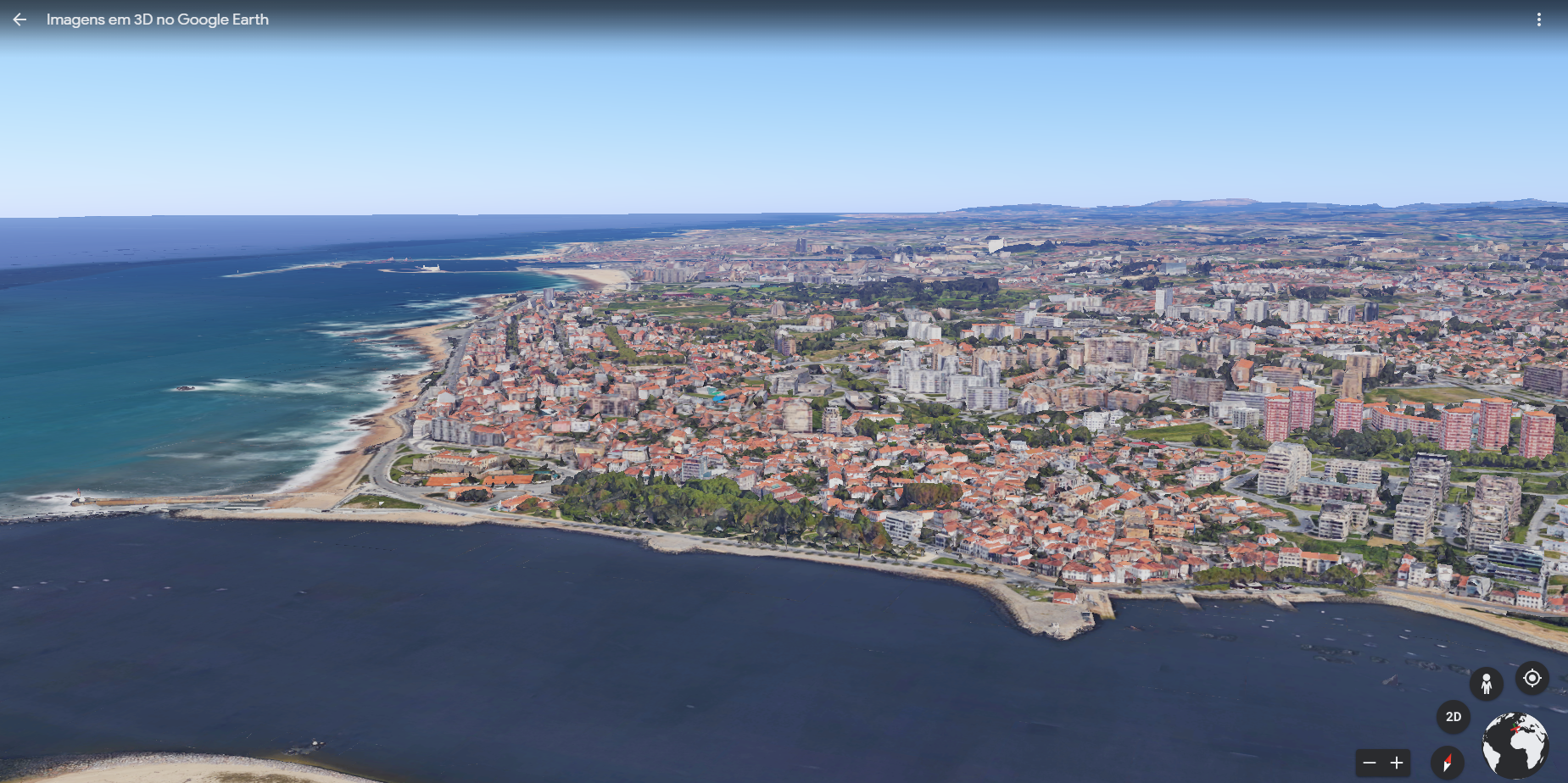
I ask you to re-direct your attention to the left window of our virtual aircraft. As you can see, we are now circling about 300 meters above the famous entry to the estuary of the Douro River. Due to its geographical location near the river Porto became an important piece in the regional chess of trade and economics, acting up as a gatekeeper of this highway of goods that ran all across northern Portugal and deep into Spain. From here, Henry the Navigator set sail to conquer the Moorish port of Ceuta in Northern Morocco, setting in motion the Portuguese Age of Discovery.
Legend tells us that the inhabitants of the city undertook the great sacrifice of delivering all their high-quality meat into the ships sailing for Ceuta. As a result, the Portuenses resorted to eat the off-cuts and the byproducts of meat, such as tripe. It is said that, because of this, those who live in Porto are known across the country as Tripeiros, a nickname everyone wears with pride. This is also one of the founding myths behind of the characteristic regional dish that every mom and grandma do better than everyone else’s matriarchs: Tripas à moda do Porto– What are those? You ask? Tripe, beans, cow feet, pork head, vegetables and with some chorizo.
But the basin of the river demanded more than high quality-food, nobility entrepreneurship and brave soldiers to keep ships sailing smoothly. The treacherous passageways required specialized sailors and captains to overcome, due to the relatively small entry-way into the basin and the shallowness of the these waters. With ships getting bigger and packing an impressive amount of water displacement. The king in 1682 finally heeded to the regional requests to start a “Work within the Rocks in due time”.
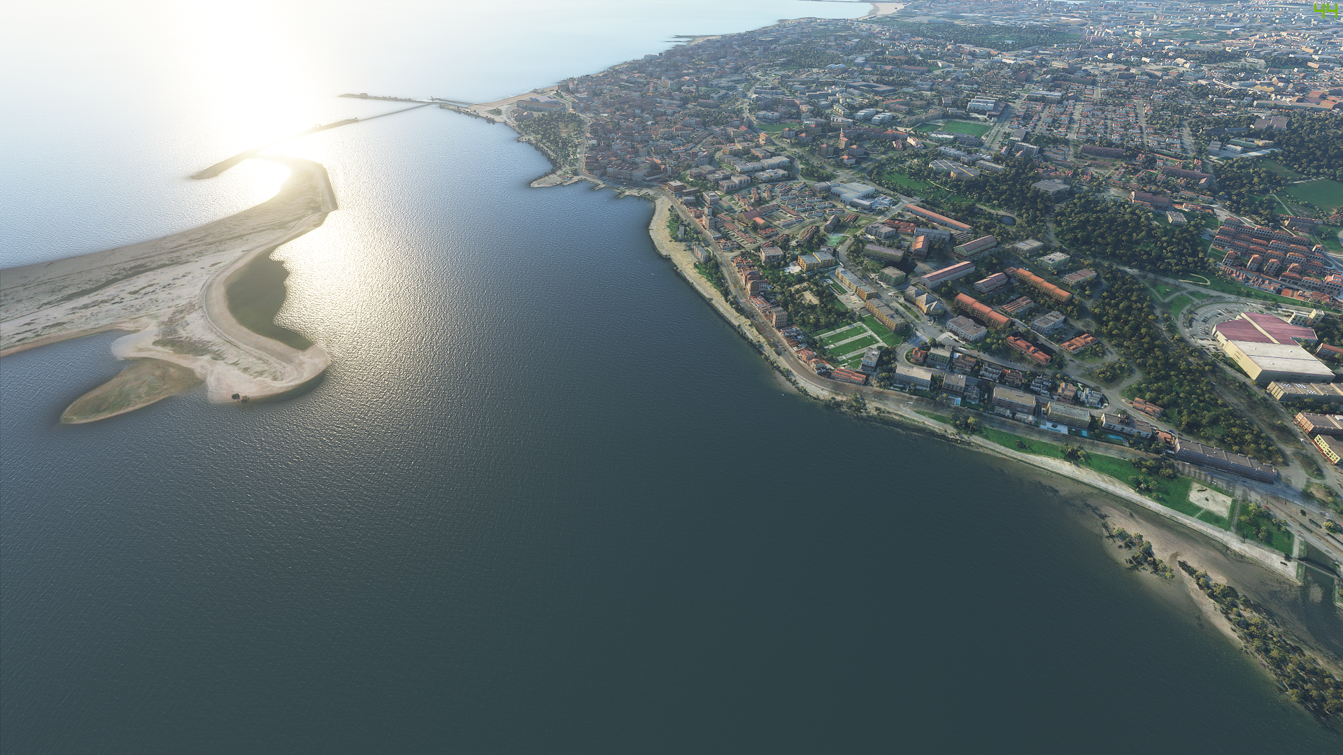
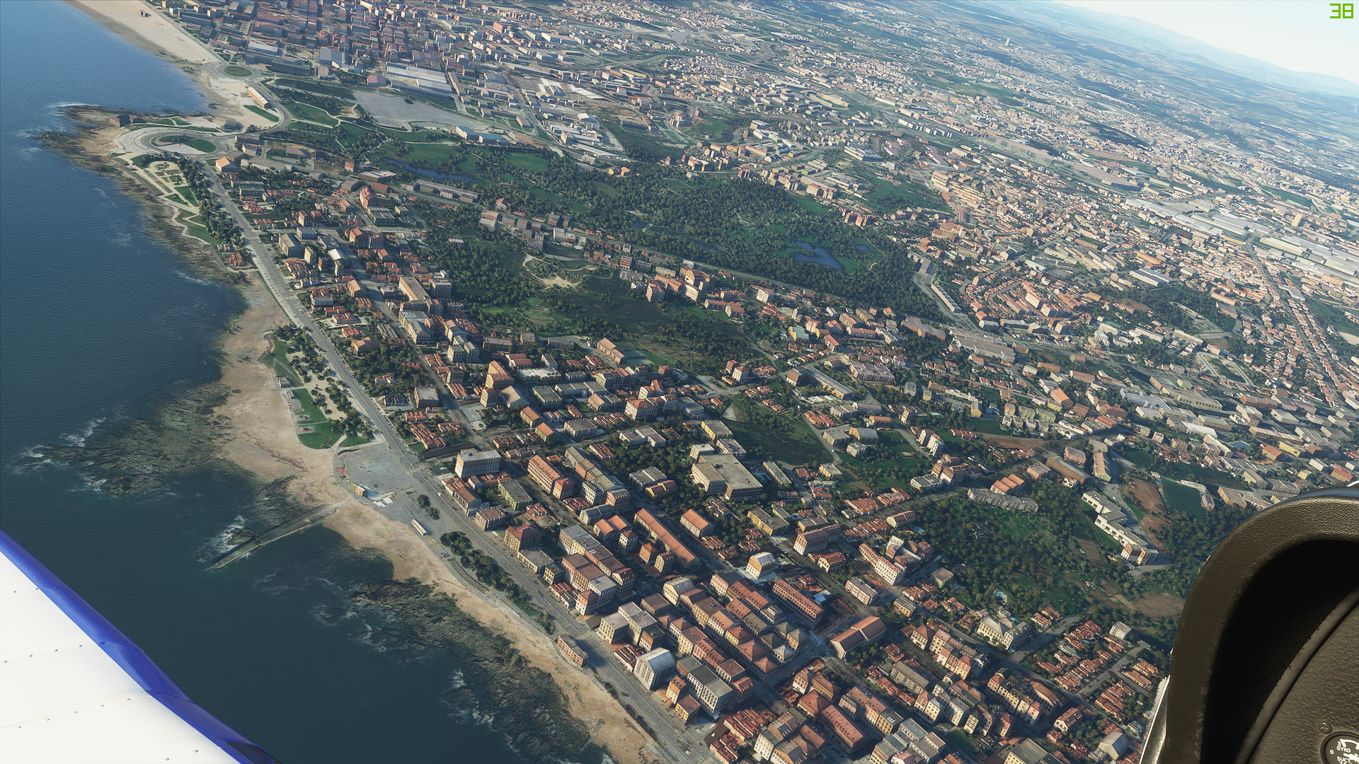
Nearly 50 years later, another attempt to dock all the international trade in good and safe conditions saw the kingdom best engineers working to remove some of the larger boulders. The entryways of the river were so paramount- in fact- for local and international commerce from a portuguese perspective that not only were rocks and obstacles removed but signs were placed, prayers were offered and financial benefits were given but the most relevant of these endeavours was the creation of a pilot corps around the 16th century that guided ships into safe harbor. Those most astute can already see that few sandy shores remains within the river basin, with only the ocean side being left untouched (for the most part). It was in these, now almost extinct riverbeds that some shipyards existed to harbor the ever increasing numbers of ships.
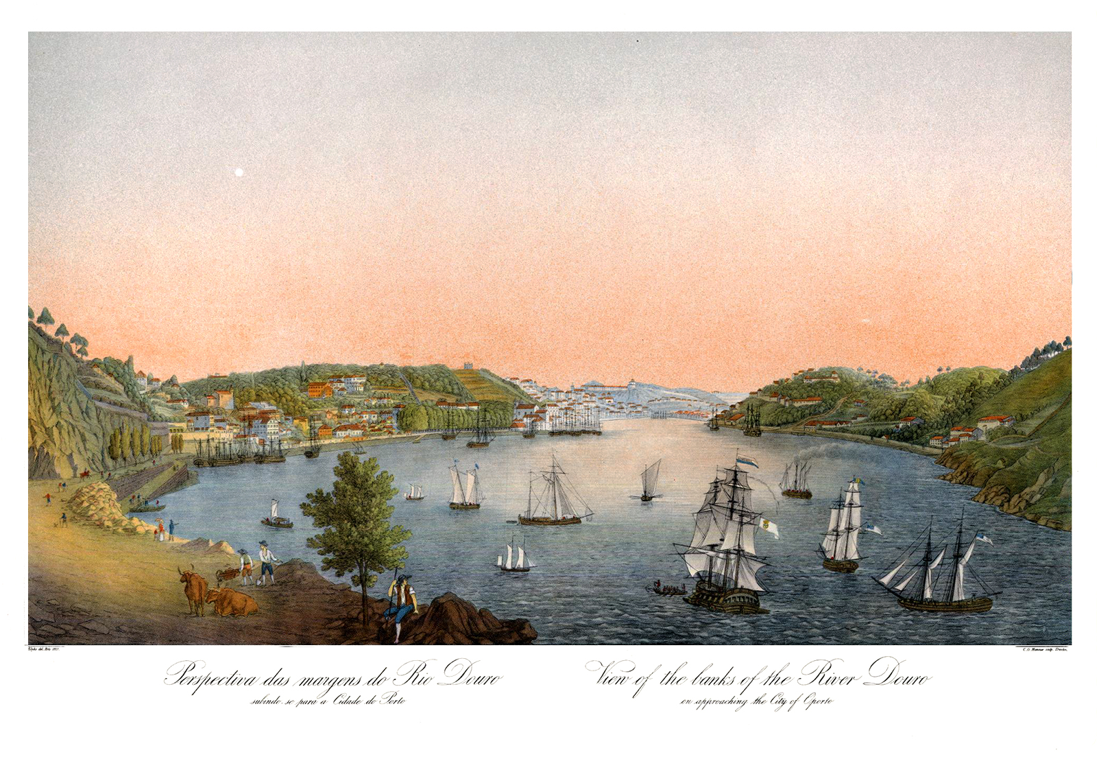
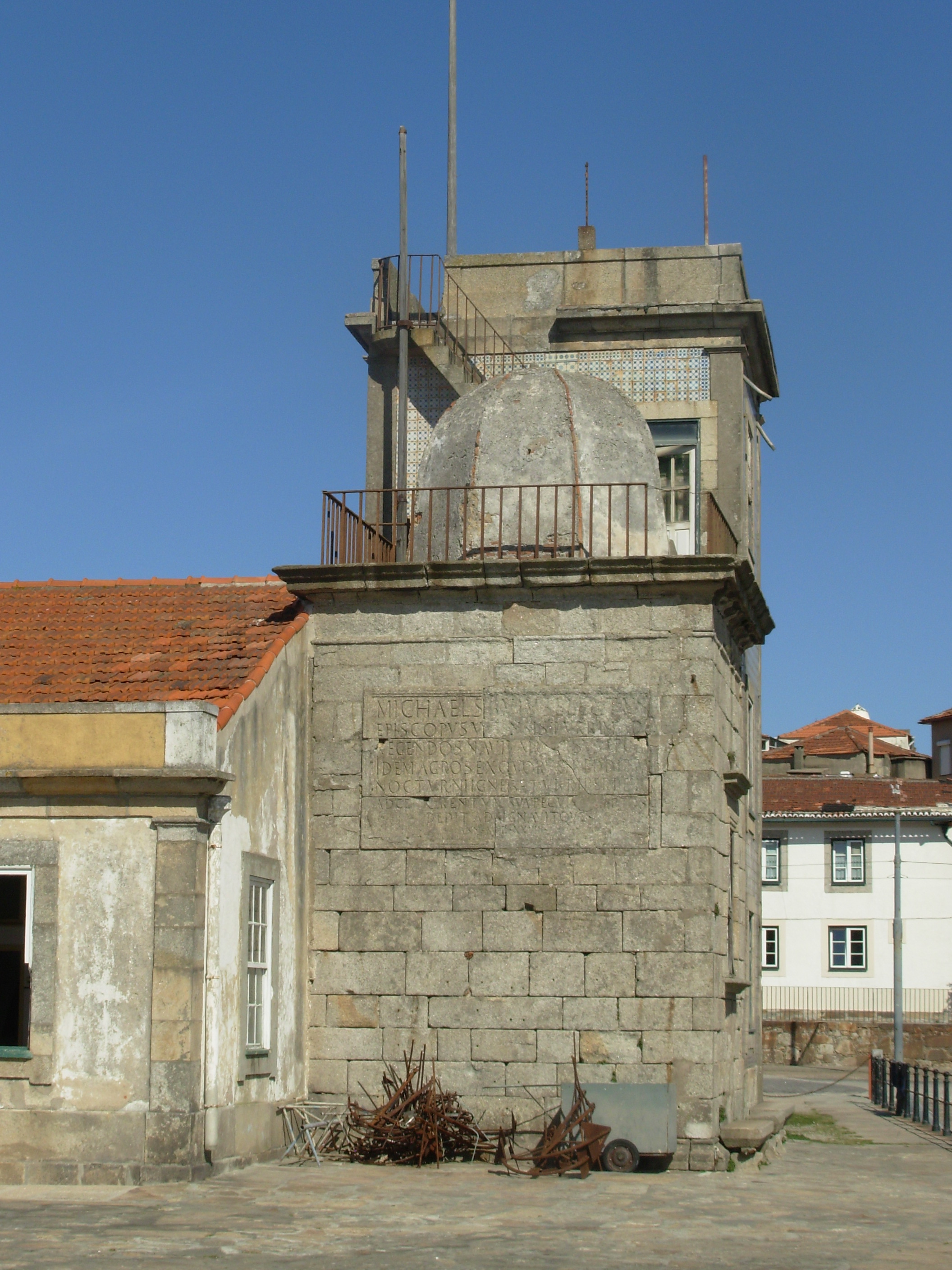
See the dangerously painted jagged edges carved upon the valley walls? The passenger can see how the river opens wide and soon shuts abruptly to open up once again. These irregular features made the crossing of simultaneous ships of different sizes and speeds extremely challenging. Fast your seatbelts because we’re now going for a low-pass around the famous Lighthouse-Chapel São Miguel-o-Anjo (Saint Michael-the-Angel). It is my duty to alert the passenger to the historical importance of such building.
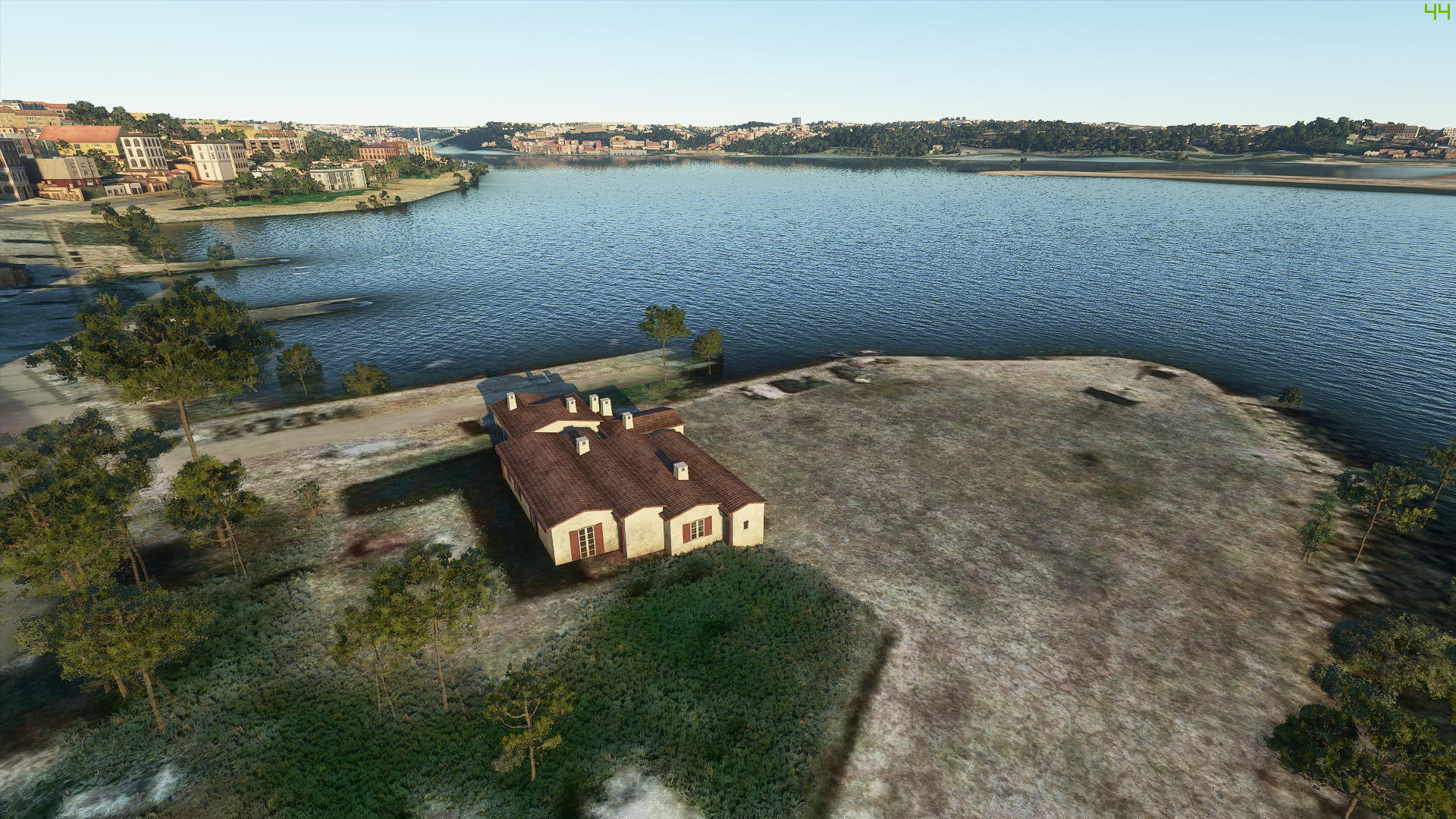
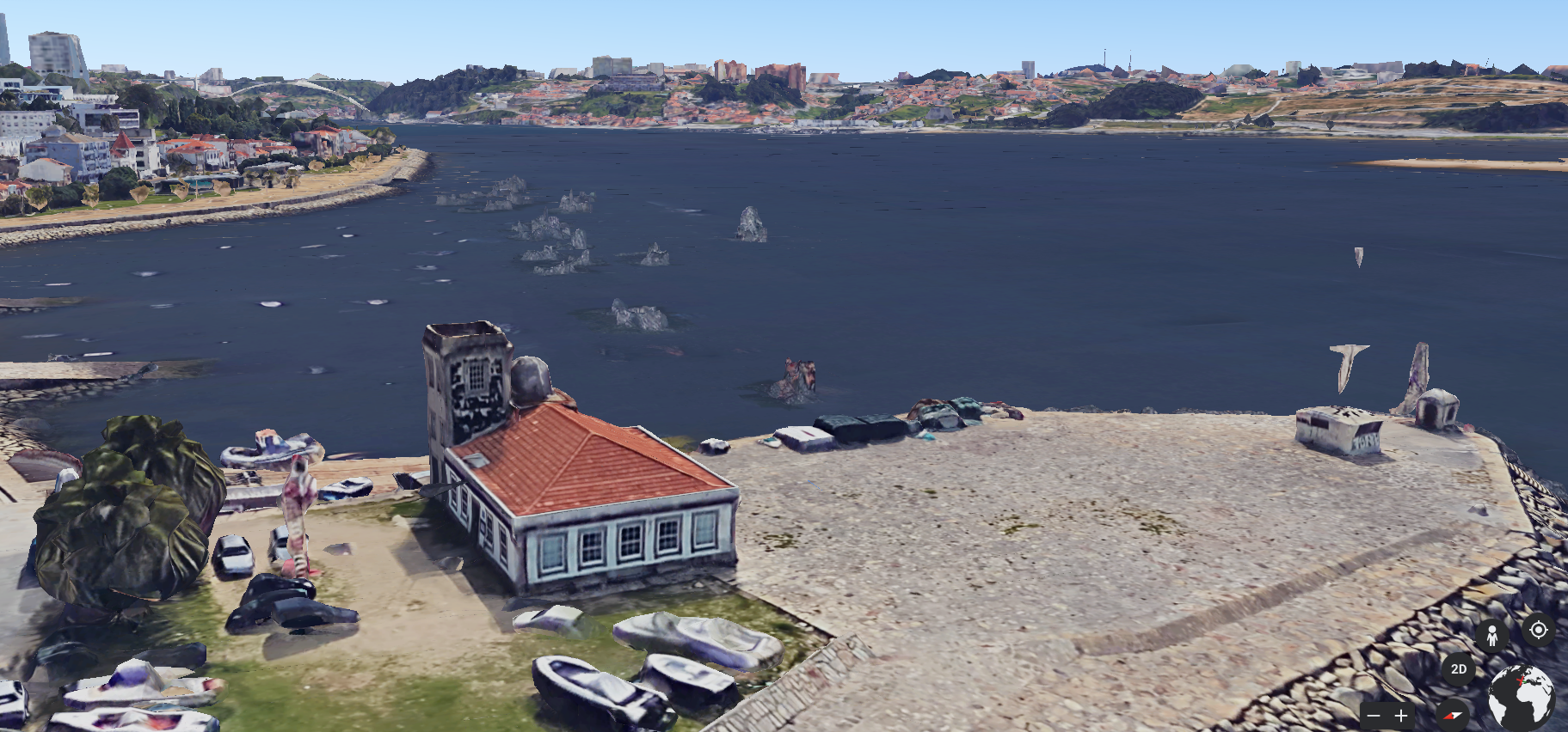
The local, underappreciated structure came to be when D. Miguel da Silva, Bishop of Viseu decided to stamp his legacy in stone. Built between 1527 and 1546, the original building was designed by Francisco da Cremona, a stonemason who learned from the famous ninja turtle and Renaissance sculptor, Rafael. The original structure consisted of a simple tower-like frame with a 8 sided-dome sitting atop where a small lighthouse was built. The Bishop went so far as to lend some lands so that even when he passed away the expenses related to the house-keeping of the edifice was assured. Several buildings were then added later as more complex navigational and water level measuring equipment was necessary.
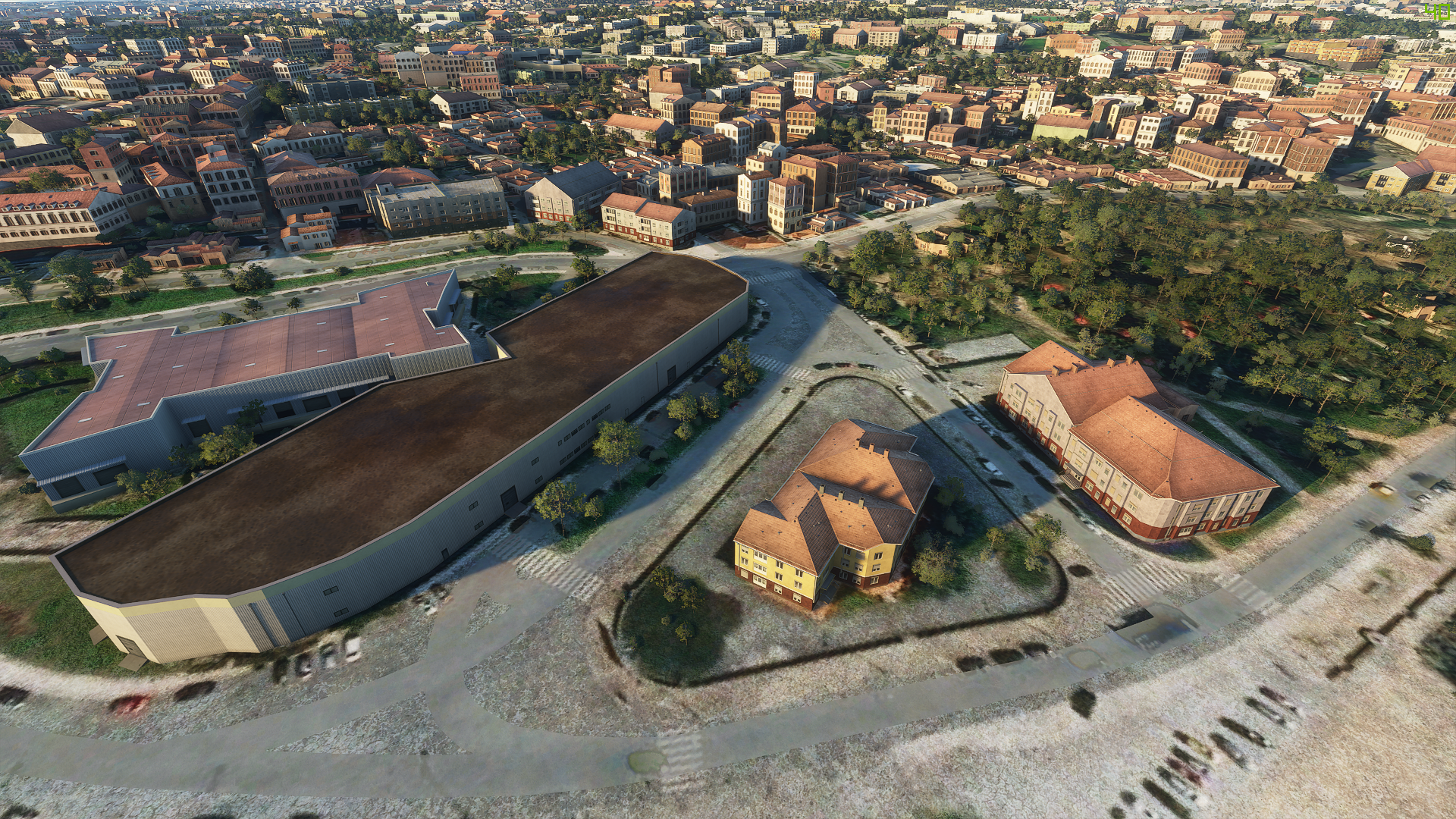
Clearly, Microsoft Flight Simulator dismantles this 500 year old historical work into a mutant building that needs 7 chimneys. I advise my dearest passengers and readers to keep themselves seated and avoid any kind of toilet-going for the time being not to miss one of the most striking features of the city. Miguel da Silva and his henchman Francesco de Cremona erected a small church a few hundred meters away from the tower of São Miguel in 1527. Five decades had passed when it was decided by the queen-regent to fortify said position so a castle was built around the original building with some adaptations and demolishing being done. The stone gigant could carry up to 18 guns but they remained silent for most of their history as the castle only saw real action 3 centuries later when it protected the disembark of liberal troops and supplies to the city during the Portuguese Civil War, fulfilling, nevertheless and despite its uneventful history, its original purpose.
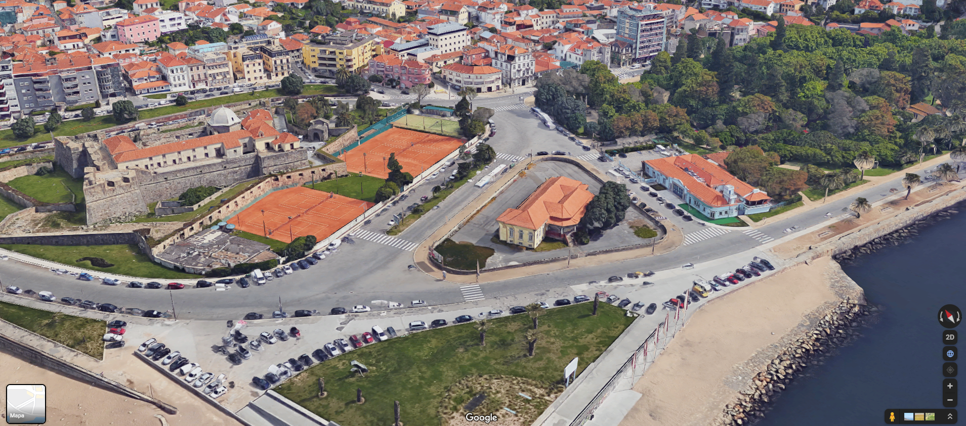
Now this star-shaped military oddity oversees only the beautiful gardens and beaches around it, an old and decommissioned elementary-school and kindergarten, a former firefighting station, two tennis courts and a mini-golf station.
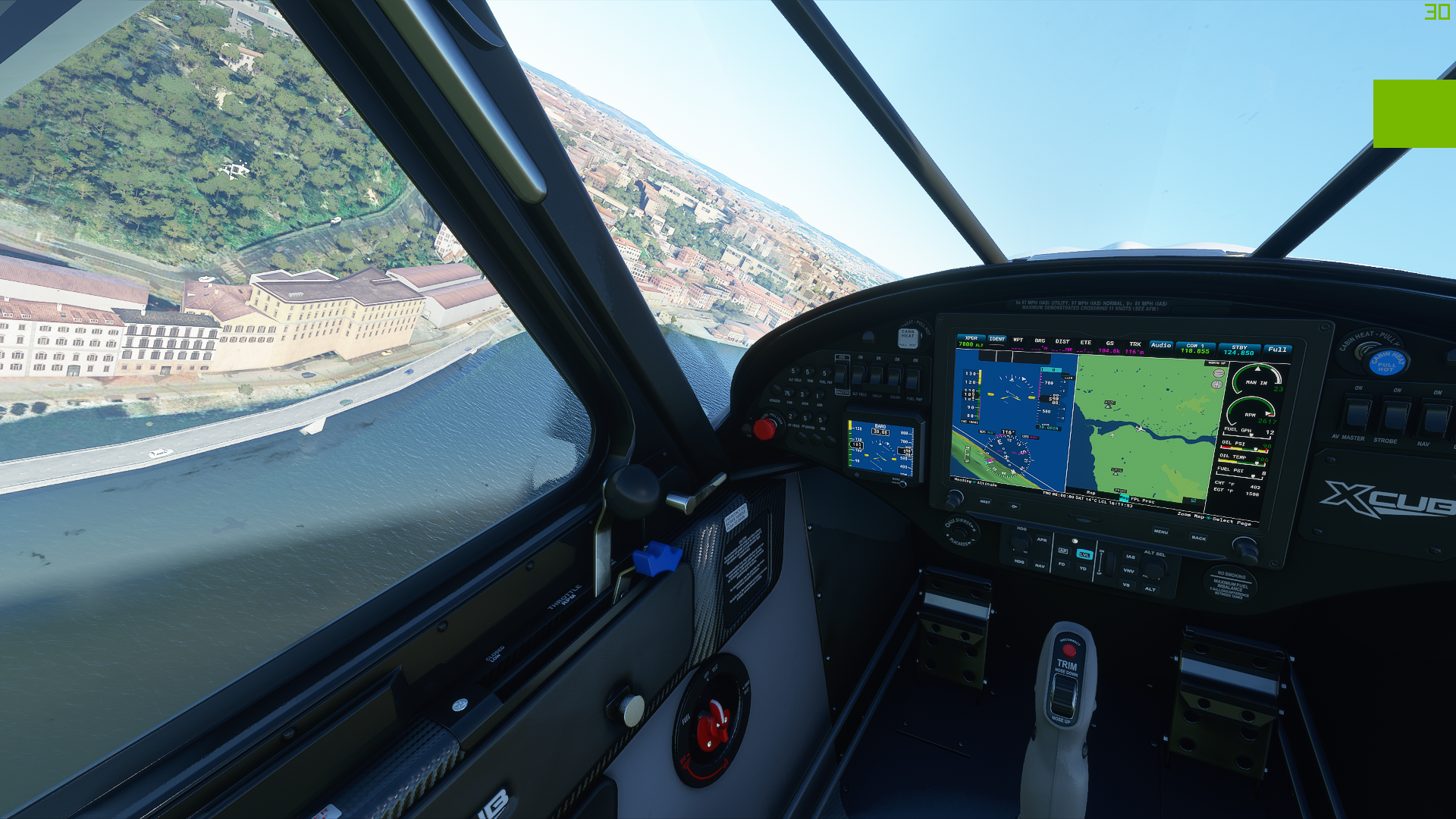
Modern day Porto is a brimming city of old oddities, unsuspecting historical peculiarities and a disturbing amount of history related to bridges. In fact, 8 bridges peppered the blue expanse that is the Douro, with all but two lasting until today. The Pontoon Bridge dates back to late medieval times to… bridge the gap between Porto and Gaia. Despite the ridiculously amount of times it had to be repaired across its history due to rain and water levels rising- the bridge served dutifully for nearly 500 years. The existence of the iconic Pontoon came to an end a couple of decades later of its most significant historical event when the portuenses– fleeing Field-Marshall Soult troops during the Napoleonic Invasion of Portugal- ran across it and placed an insurmountable strain upon the barges. So much in fact that it collapsed, killing thousands, or so its being said. This pontoon was later replaced by a hanging bridge named D. Maria II. The famous french engineer Gustave Eiffel (yes, that one) worked on the D. Maria Pia Bridge in 1876 and that bridge remained for years as the largest iron arch in the world with a span of nearly 160 meters.

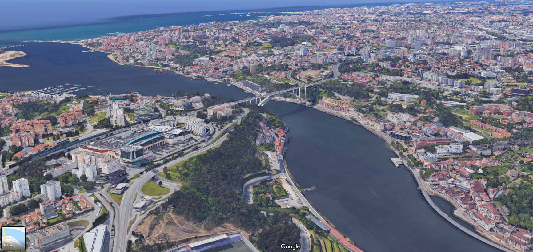
The bridge we spot from above is one of the most recent ones, dating back to the 1950’s. It was decided that it was necessary to erect another bridge due to the amount of road traffic going back and fourth between Porto and Vila Nova de Gaia. For years, Arrábida was the world largest concrete bridge. Microsoft Flight Sim is great at outputting verisimilitude when it comes to road networks and city layouts but it still lacks the finesse necessary to recreate iconic buildings that really make a city all that much memorable and unique.
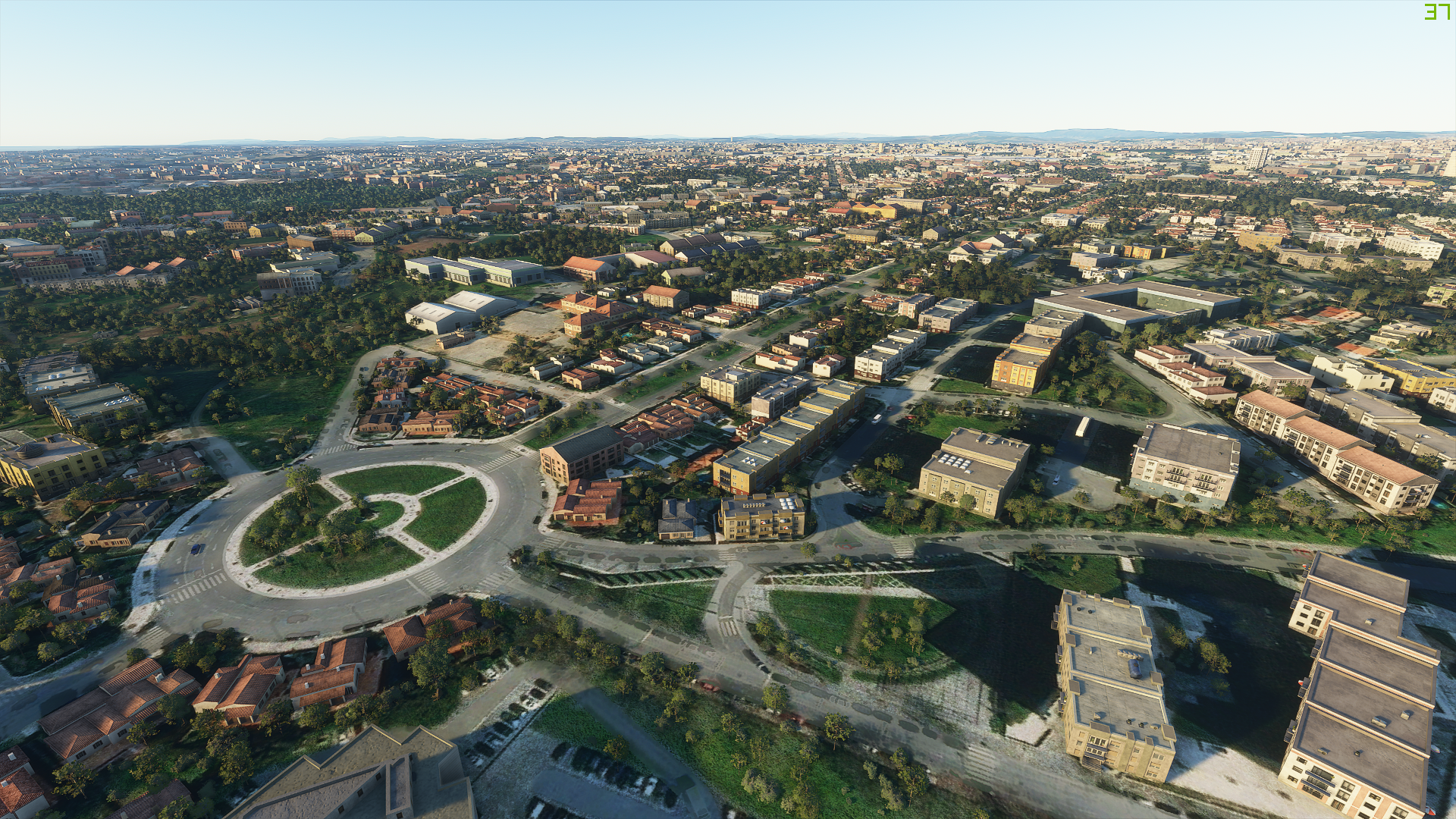
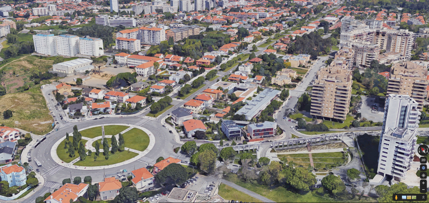
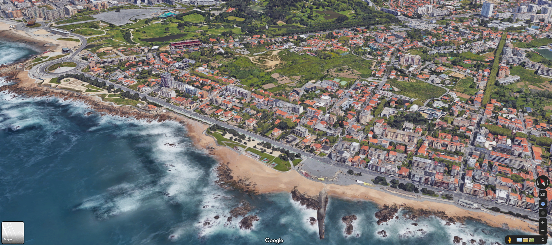
It is still impressive to me how it can capture the overall feeling of a location just with its algorithm. See above at how well it captures one of the cities most iconic roundabouts, even the pedestrian walk around within the structure. In fact, it manages to even recreates the exact same number of gardens in-between the street lanes and the parking spots inside Catolica University.
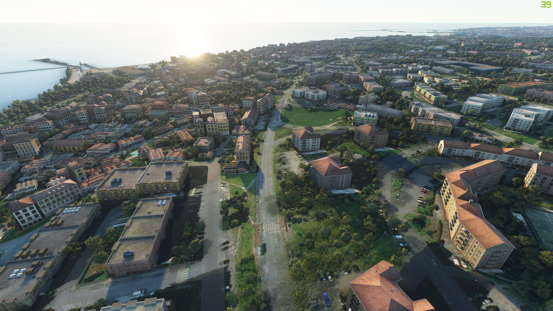
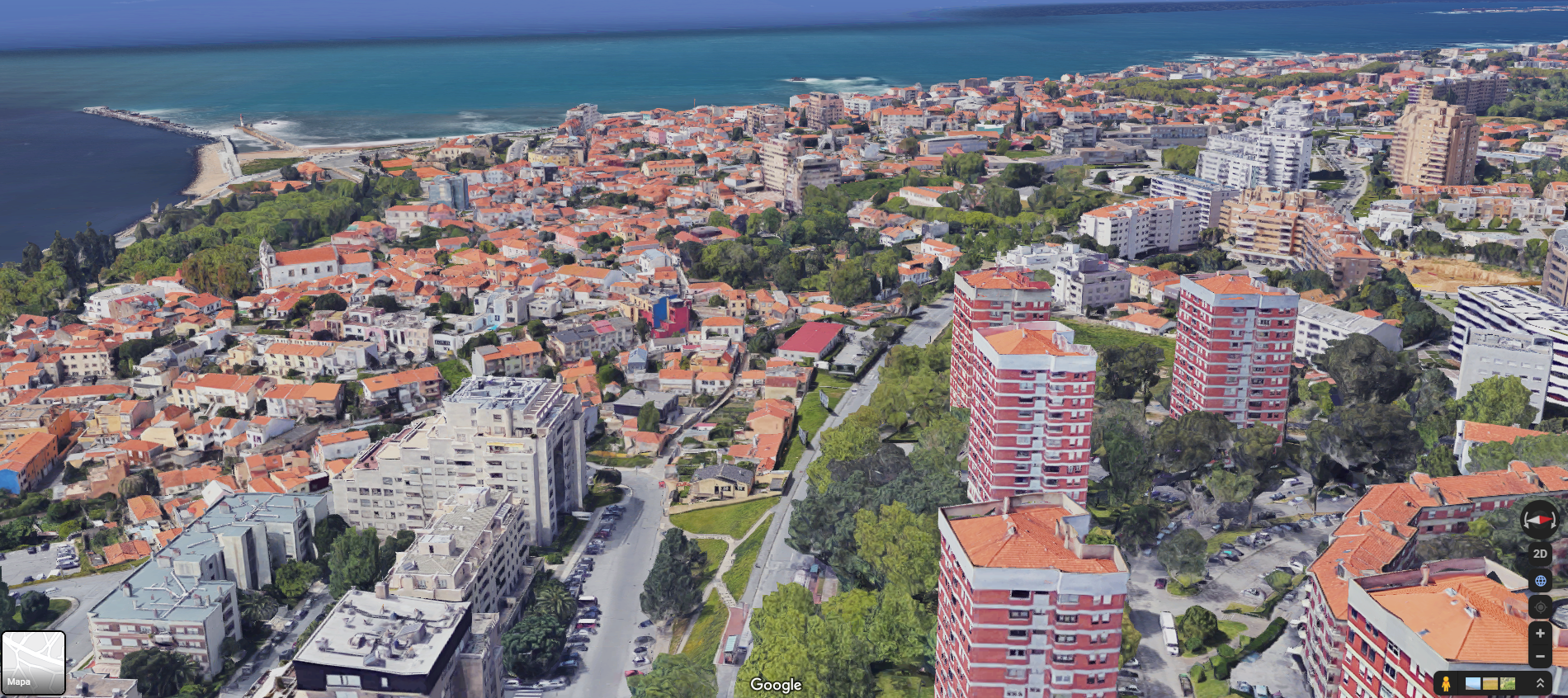
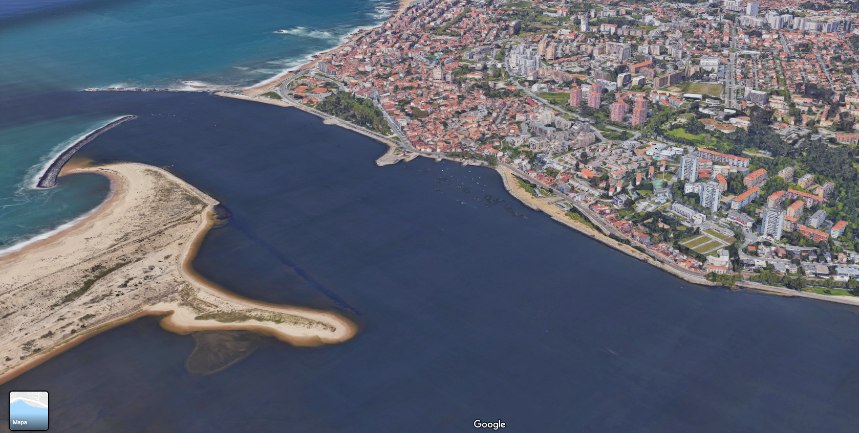
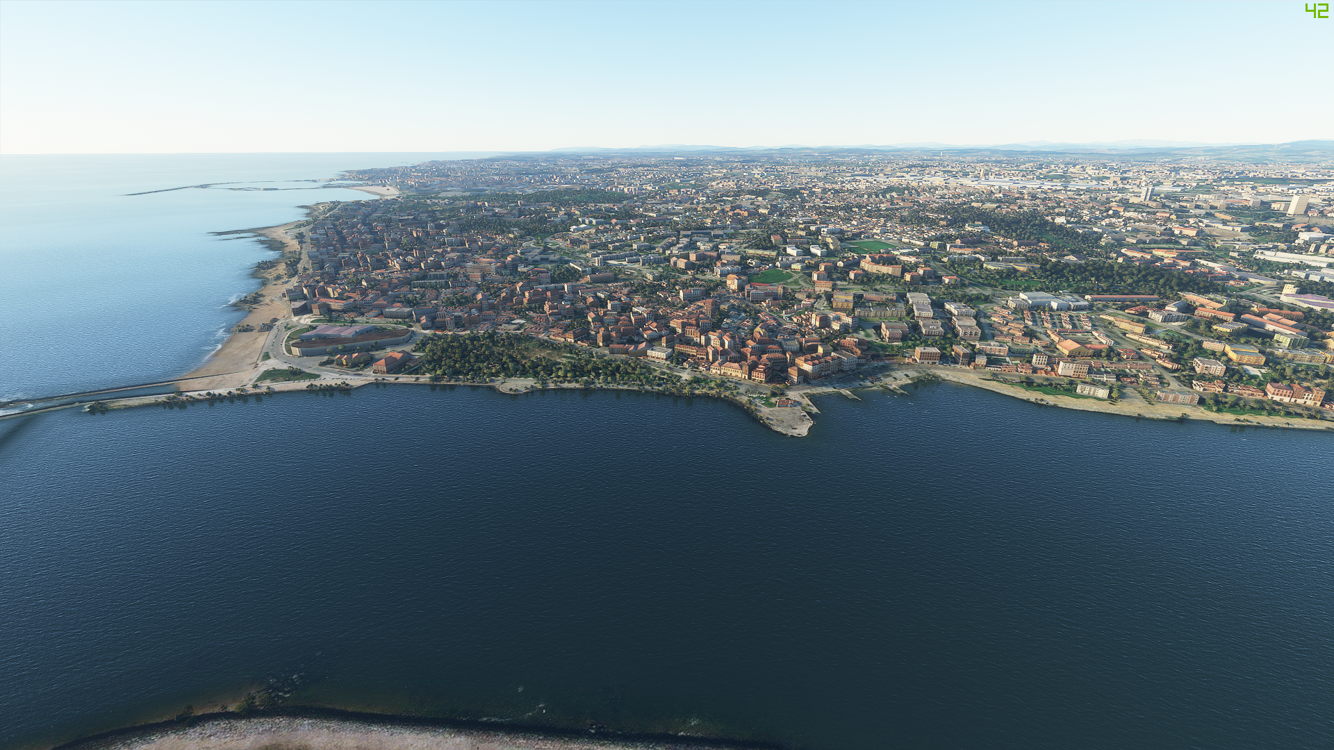
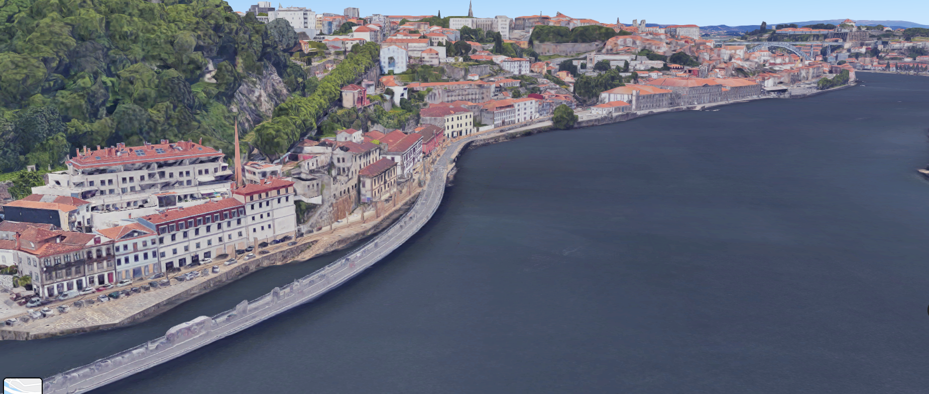
What the game struggles the most is in it’s interpretation the buildings height. The striking difference between the real-life google maps is apparent when daring dogfighters are doing low-passes in their aircraft. Some of the most striking structures in the landscape melt into small edificies, despite maintaining their overall appearance and generic shapes. It loses some of its glamour but one cannot argue against the technological achievement that Asobo Studio developed.
When viewed from above the differences are zero to none as every single buildings is methodically placed on the map with its overall shape represented when viewed from above. This amount of detail extends to even the City Park tree density and the precise locations of its’ two large ponds. Overall, the faults may be many, as one could expect, but the feeling and satisfaction of flying across your own city and recognizing the places you see everyday make it all the more special.
Ladies and gentlemen this is your captain speaking, we will start descending soon, please fasten your seatbelts.
Ladies and gentlemen on behalf of Uff! I’m glad I landed it in one piece Airline, I would like to welcome you to Porto, Portugal. Please enjoy your stay and don’t forget to eat a francesinha. Thank you for choosing I can’t believe I’m alive Airline, have a fun, memorable and safe trip!
Thank you.
Follow Strategy and Wargaming Socials
If you enjoy Strategy and Wargaming, then you need to follow its socials. Are we the best strategy gaming website around? I would say so. Heck, what other options do you have? The Wargamer? Please.
So why not give us a follow on the cesspool that is Twitter, or join the 1000 other geriatric patients on Facebook? Or subscribe down below? Or maybe do everything? I don’t care, I’m not your grandmother.
If you enjoyed the article, consider buying me a coffee!
I’ve been running Strategy and Wargaming at my own expense since 2017, with only the ad revenue to cover the hosting, with everything else being done by me. So, if you’re an avid reader, you can afford it, and want to support the website, please consider Buying Me a Coffee by clicking this link, for as low as one euro! If you do, just know that you’re helping out a lot and contributing so that Strategy and Wargaming can continue growing!


Leave a comment